|
Overview
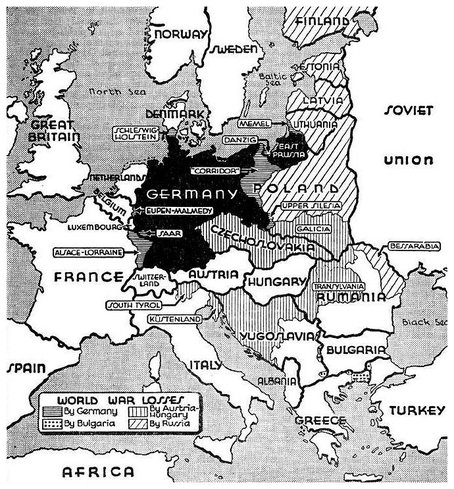
"A century ago at the beginning of the First World War, the maps of Europe, Asia and Africa looked much different than they do today. Historians say many of the border changes - agreed upon after the war - were made for political rather than economic reasons, creating new problems whose impact can be felt even today. After four years of carnage and more than 16 million dead soldiers and civilians, three empires that had lasted for centuries - Austro-Hungarian, Russian and Ottoman - gradually ceased to exist and many new nations emerged, says Mike Heffernan, professor of historical geography at the University of Nottingham." |
|
The Austro-Hungarian Empire
|
|
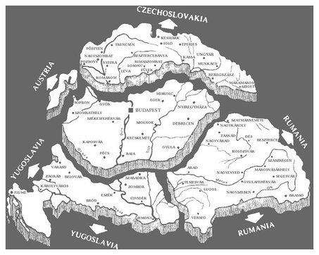
^The division of the Austro-Hungarian territories // And post-war territorial changes ^
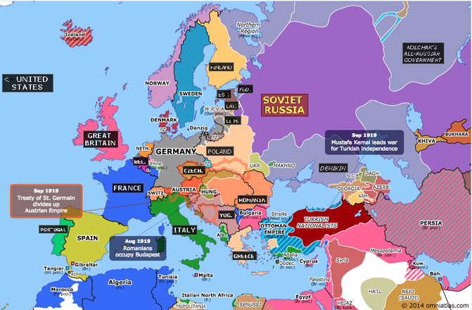
The Austro-Hungarian Empire was divided up by the Treaty of Saint-Germain-en-Laye (1919).
Two other treaties dealt with the Austro-Hungarian Empire:
The Treaty of Neuilly and The Treaty of Trianon.
The Treaty of Neuilly and The Treaty of Trianon.
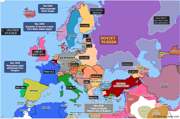
The Treaty of Neuilly dealt with Bulgarian aggression on the Mediterranean Sea with Greece.
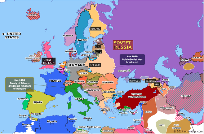
The Treaty of Trianon dealt with the division of Hungary.
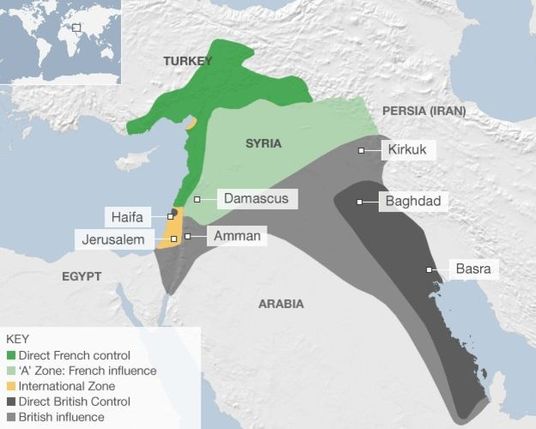
The Ottoman Empire
The Treaty of Serves and the Sykes-Picot agreement dealt with the division of the Ottoman Empire.
The Treaty of Serves reduced the size of the empire from 614,000 square kilometres down to 175,000.
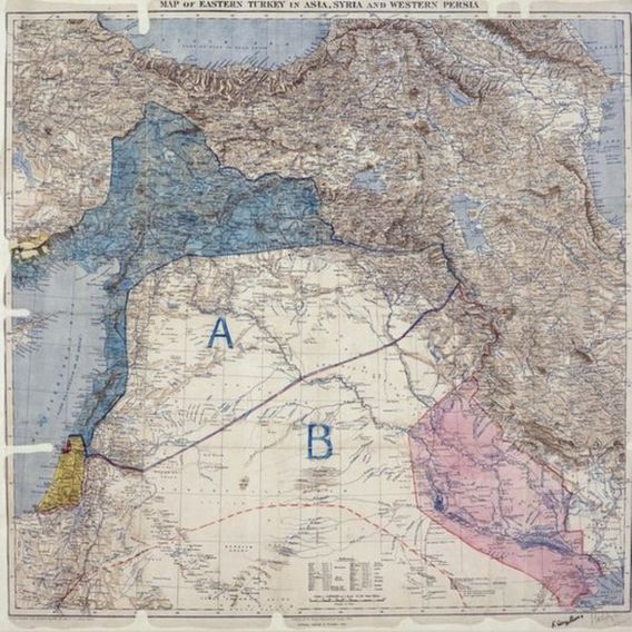
The original Sykes-Picot agreement with
A to France
and
B to Britian
"Sykes-Picot agreement was a secret understanding concluded in May 1916, during World War One, between Great Britain and France, with the assent of Russia, for the dismemberment of the Ottoman Empire."
Result of the redrawing of boundaries:
Other cool interactive maps and activities:
Interactive map
http://www.worldology.com/Europe/pre-war_imap.htm
Narrated visualization
http://www.the-map-as-history.com/demos/tome03/
Quiz of new boundaries
http://www.theguardian.com/world/ng-interactive/2014/aug/04/first-world-war-how-europe-middle-east-map-changed
Interactive map
http://www.worldology.com/Europe/pre-war_imap.htm
Narrated visualization
http://www.the-map-as-history.com/demos/tome03/
Quiz of new boundaries
http://www.theguardian.com/world/ng-interactive/2014/aug/04/first-world-war-how-europe-middle-east-map-changed
